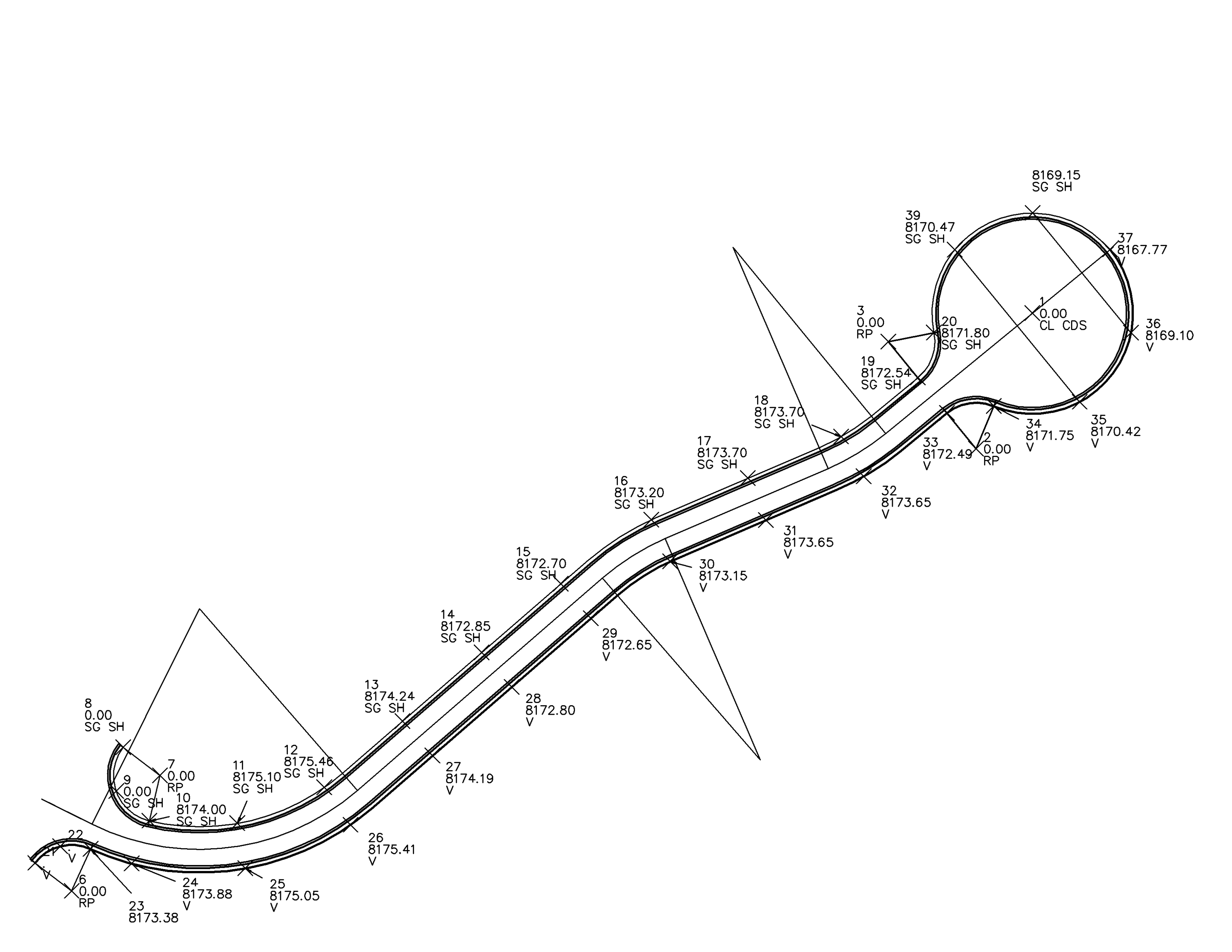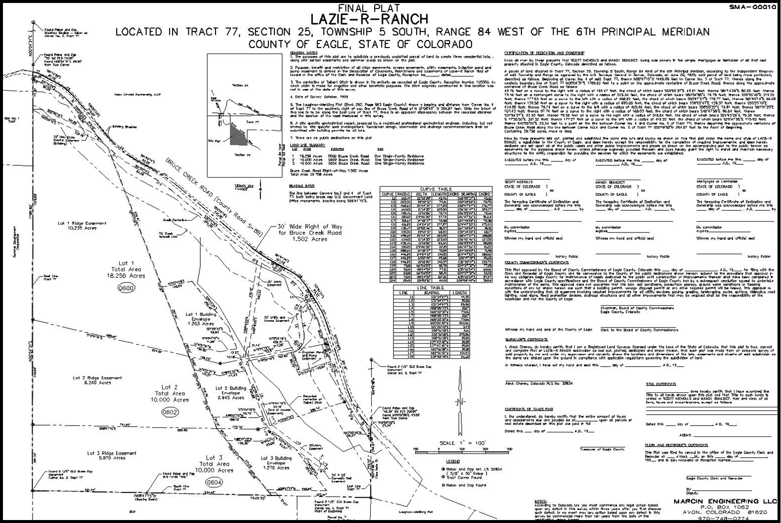
At Marcin Engineering, we provide professional land surveying services for creating legal property boundaries, roads, right of ways, easements, site layout, infrastructure, utilities, and more. We maintain a full service land surveying team, working hand in hand with our civil engineering staff. Through the use of state-of-the-art field equipment with automatic data collection, our surveyors provide accurate ground control which forms the basis of our design work and construction projects. Precise surveying is a fundamental key to acheiving cost-effectiveness and project success.
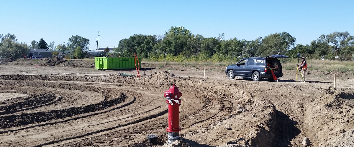
During construction, our surveyors are on site to ensure accurate placement of all improvements. Our surveying department is specially trained and experienced in construction staking/site layout. We believe these skills set us apart from other land surveying companies. Whether slope staking for a new road in the mountains, a new sanitary sewer main, or the foundation for a high-rise building, we employ advanced techniques along with good old-fashioned communication. Our highest priority is to make sure our field work is thoroughly understood by the contractor. Strong communications between the engineer and contractor in the field minimizes costly construction delays and gives our clients a greater degree of confidence that their project will be a success.